Sunday, February 27, 2011

New Mexico

The last week has been spent dubbing around in New Mexico looking for possible winter fishing spots. Marlin did his homework and had researched New Mexico lakes and streams, where you could fish at this time of year. He found four possible sites just north of the Texas border in New Mexico, so we headed in that direction. The results weren't quite what we expected. The two "lakes" closest to Texas were man-made ponds inside City parks. Although the setting was pleasant enough, it wasn't quite what we were looking for.


We moved toward the center of the state where a friend had recommended great fishing opportunities. These were dam created lakes on sections of the Rio Grande. The water levels were very low in the lakes, and when a camp host said he had not seen anyone catching fish from the shore, that a boat was really necessary for any fishing, the tackle box was buried back where it had been hidden under chairs and books.


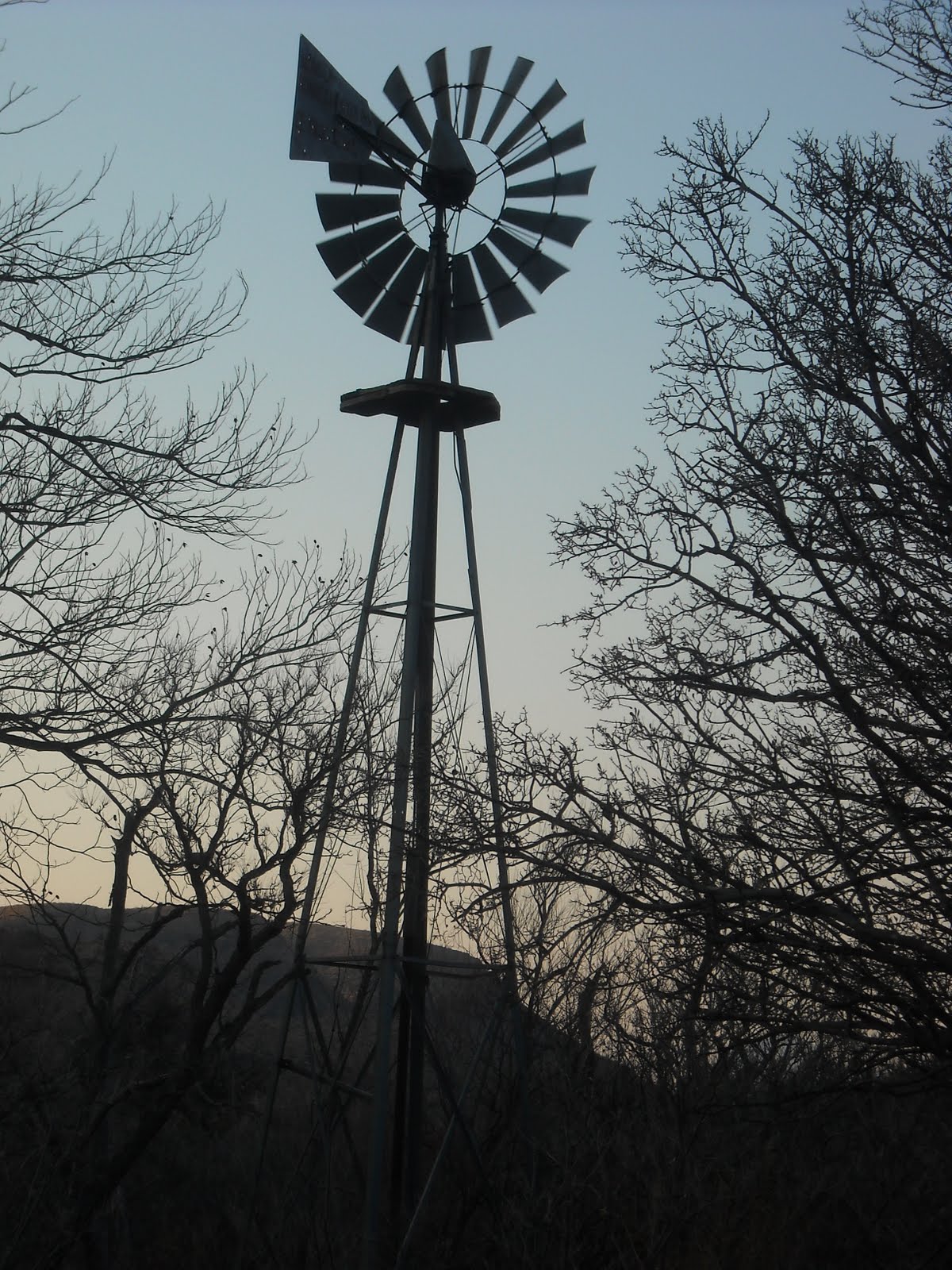
Our last sunset in Texas


Our next stop was to be Silver City on the western side of NM. While in Seminole State Park, we had met a couple who were headed there to be hosts at the Gila cliff dwelling site. They loved Silver City so we decided to check it out. The trip took us over a pass with a view of the White Sands National Monument in Alamogordo. In New Mexico, it seems you drive for miles and miles in flat, dry, scrubby desert, when suddenly you are climbing through ancient, uplifted layers of limestone or magma outcroppings, over six or eight thousand foot passes and down through spectacular views of more flat dry desert.


The white sand that make up the dunes in White Sands National Monument are created from gypsum deposits laid down millions of years ago. Wikipedia explains it like this:

Gypsum is rarely found in the form of sand because it is water-soluble. Normally, rain would dissolve the gypsum and carry it to the sea. Since the Tularosa Basin has no outlet to the sea, rain that dissolves gypsum from the surrounding San Andres and Sacramento Mountains is trapped within the basin, and the rain either sinks into the ground or forms shallow pools which subsequently dry out and leave gypsum in a crystalline form, called selenite, on the surface.

White Sands National Monument in the distance. It looks like snow on the desert from here.


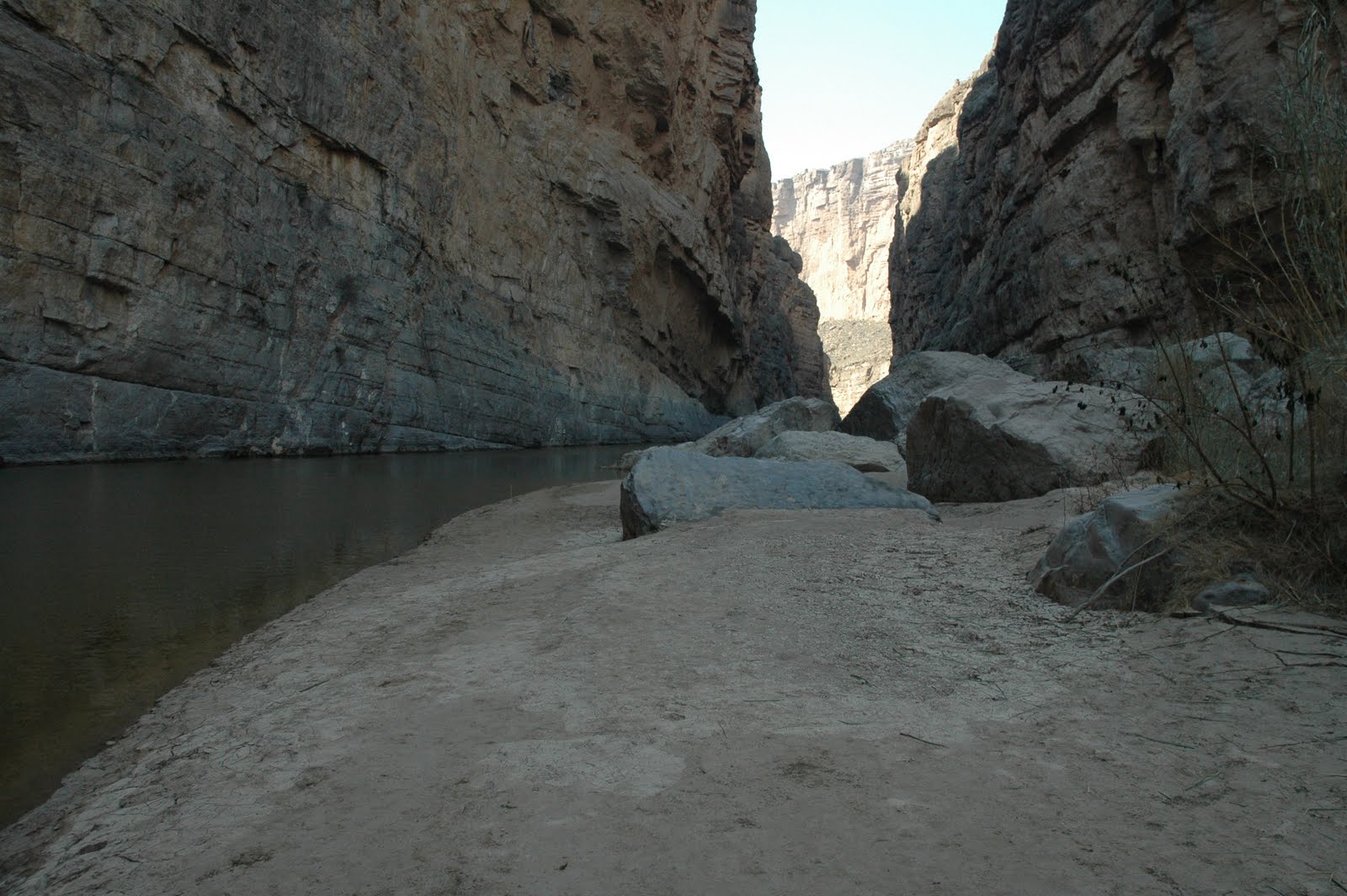
Elephant Mountain Dam and State Park, NM. Where is our boat when we need it!


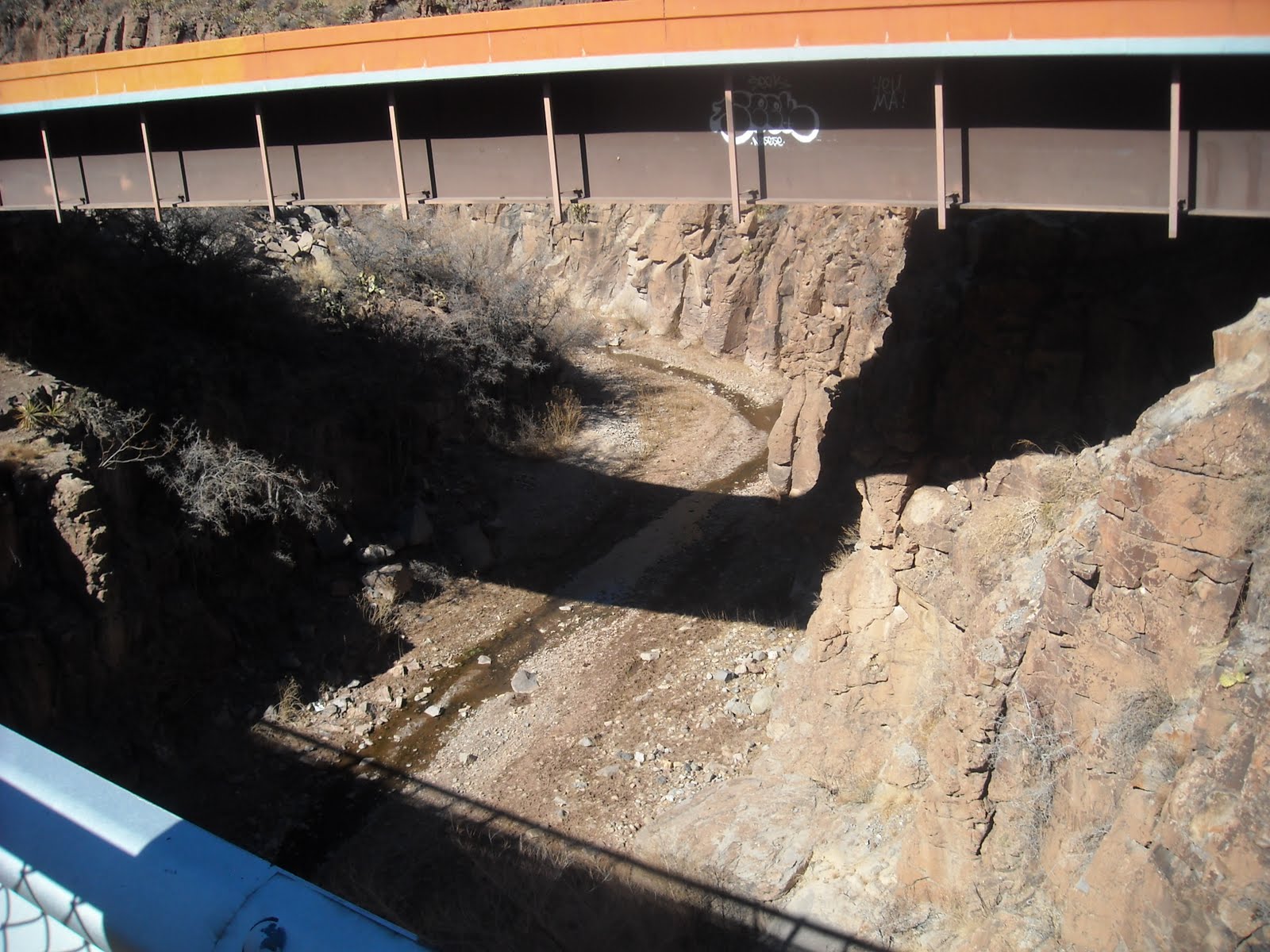
A bridge built over a steep gorge on one of the mountain passes in NM


Another pass in New Mexico


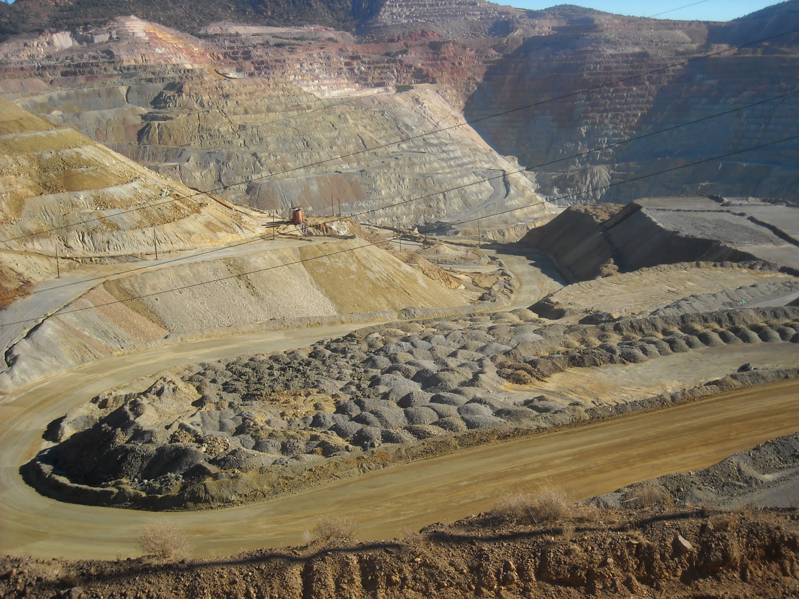
There were several industrial mines scattered in the mountains of southern NM. You cannot even see the bottom they are so deep. This one has been worked since the late 1800's


Our stop in Silver City ended up consisting of only one night. The weather report was for a severe cold front arriving the next night with snow in the mix. Life in our rig can be tolerated with temps in the mid 30's, but below that, or snow, is just more than the pop-up (or us) can tolerate. So again, we changed plans and moved on to Arizona, hoping to avoid the worst of the weather. After stopping to visit a cousin in Tucson, temps were still predicted to be near freezing that night, so we opted for a hotel.


Sunday morning this was the view out our hotel window


and through the windshield of our truck. Tucson received 3 inches of snow overnight. Now I realize that even mentioning three inches is laughable considering the three feet on the ground in Maine, but for Tucson, which is usually in the 70's this time of year, it was a big deal.


Tomorrow we are headed for Joshua Tree, California, still looking for warmer temperatures. The forecast does not look good.


Monday, February 21, 2011

Fort Davis to Big Bend

After camping at Davis Mountain State Park for three nights we have decided to buy a ranch here and raise horses! Not really, but if we had visited here when we were, say 20 or 30, we may have done just that. Fort Davis, a town of approximately 2000 residents in West Texas, has an elevation of 5,050 feet which makes the terrain and temperatures substantially less severe than other areas in this local. Summer temps average around 88 degrees, with a low of around 30 in the winter. Beautiful rolling hills of golden, knee high grass dotted with live oak and cottonwood trees stretch as far as you can see


The original for in Fort Davis was built in 1854. It was established here to protect the settlers, mail carriers, and freight haulers from Indian raids. Today the restored Fort is an outstanding example of what a frontier fort was like and a focal point of the town.


Our campsite at Davis Mountain State Park


View from Skyline Drive


Indian Lodge is a restaurant and lodge within the park that was built by the CCC circa 1935. In 1933 the CCC arrived in the Davis Mountains to begin construction of the State Park on land donated by local land owners. They constructed Skyline Drive up to the top of the highest hill in the park, and a 16 room adobe lodge. The lodge was built with large beamed ceilings lined with cane harvested in Big Bend, hand carved cedar furniture, and unique fireplaces that are still used today. An additional 24 rooms, swimming pool, and restaurant were added in 1967, and another 24 rooms were built on in 2002.


Indian Lodge office at the entry drive


An interior patio


CCC built picnic shelter at the top of Skyline Drive.


Fort Davis is also the home of McDonald Observatory. McDonald Observatory, is a research unit of The University of Texas at Austin. According to our guide, in 1932 a local resident left money for the University to establish an observatory on donated land on the top of Mount Locke. Unfortunately the University of Texas did not have an astronomy department so it went into partnership with the University of Chicago, who did have a department but no telescope. Today, McDonald Observatory is one of the world's leading centers for astronomical research, teaching, and public education. Observatory facilities that are located in the Davis Mountains, which offer some of the darkest night skies in the United States.


On the 16th we spent four hours at the observatory. The scheduled tour began at 2:00 so we arrived ½ hour early to view the exhibits in the visitor’s center. Rachael was our tour guide. An astronomer herself, she exuded enthusiasm and knowledge about the facility as well as the subject matter. Her job was public education and she was certainly well suited for that job.


Rachael our guide at McDonald Observatory


The guided tour began with ½-hour presentation in the theater about the sun and stars and how it is studied with spectrograph technology here at McDonald. So much information was presented that at the time I thought I was following along but later when I tried to write some of it down the data had escaped totally from my brain!


After the theater presentation we visited the 107-inch Harlan J Smith telescope, which was the third largest in the world when it was built in 1968. This telescope is used every clear night by astronomers who must submit a study proposal to a board before they can be scheduled for a time to visit the observatory and use the telescope.


Our tour also included a visit to the Hobby-Eberly telescope which has a 433 inch composite mirror and is the 5th largest optical telescope in the world. It is optimized for spectroscopy, the decoding of light from stars and galaxies to study their properties, making it ideal for searching for planets around other stars, and studying distant galaxies, exploding stars, black holes, and more. The observatory houses several other smaller telescopes that we did not visit but they continue to be used every day.


All the data collected from these telescopes is transmitted by computer to a control room where astronomers view the information as spectrographs on computer monitors. They never actually view the stars through the scope. Our guide told us that the majority of astronomy today is done with spectrographs. These graphs tell how bright, how far away the stars are, and what the stars are made of, all from the colors of the spectrographs. Sounds simple; right!


Two of the McDonald observatories from the visitor parking lot


Looking east from the observatory


and west


The computer that moves the 86 inch telescope


Sun Dial at the visitors center


A diagram of the 107 inch Hobby-Eberly telescope and building


The dome was constructed locally to save on building costs


The green tubing supports each individual mirror and adjusts each one individually when they are not precisely aligned. These supports were also produced locally to conserve funds. It is difficult to see by above the green tubing the thin silver line is actually the telescope mirror. This 433 inch surface is actually made up of over a hundred individual hexagon mirrors pieced together to form a whole.


On Friday the 18th we drove the 110 miles south to Big Bend National Park. The results of millions of years of volcanic activity visible in this area is overwhelming. Layer over layer of different types of volcanic events that are now visible through exposure by wind and water weathering. The colors of ash deposit, dikes, magma plugs, are exposed and visible on top of each other in some of the remaining formations. Seems like this place would be a geologists dream come true. It feels very pre-historic, like the computer generated models of cataclysmic events. My pictures all look alike - rock and more rock. It is an amazing place that photographs do not portray.

Over the last two weeks I have swung from wishing I had a degree in archeology, astronomy, plant biology, and geology. Visiting this region of Texas makes me realize just how much I do not know about prehistoric man, the universe, desert flora, or geology. It is all fascinating.


Throughout the park remains of past business and ranches are visible. Many have trails leading to old ruins. We walked into several sites. This is one of the windmills still working and pumping water on the Sam Nail ranch which was taken over when the area became a National Park in the 40's


An old broken windmill at the remains of Sam Nail's ranch, abandoned in 1945 when the park was opened.


A view of Tuff canyon from above. For some crazy reason we decided to hike down into this canyon


and below. Lots of evidence of spring and summer floods that scrub away more rock.


These desert plants are "some tough" This prickly pear was growing right out of a crack


The canyon is narrow because this type of volcanic rock resists the broad erosion seen in other washes. As you walk through you can see the variety of rock types in each layer.


A morning visit through our campsite at Casleton's Cottonwood campground. This group of javalinas came into the clearing one at a time until all 9 wandered out the other side


Santa Elana Canyon. Hard to believe water carved this canyon through the uplifting rock.


Getting ready to hike the Santa Elana overlook trail


The beginning climb to the trail


Going up the switchbacks


At the floor of the canyon the Reo Grande looks very tame this time of year


On our way out we saw this poor bat making tracks through the sand into the grass. Don't know why he was out in the day so we kept our distance.


Sunday, February 13, 2011

Back to Texas

February 7, the day after the Super Bowl, we headed for Texas again. Before we left the state of Alabama we happened upon a charming village on the edge of the gulf named Fairhope. There was an inviting park between the road and the ocean that appeared just when we needed a break, so of course we stopped. The town is populated with quaint cottages as well as large “summer homes” One of the cottages supplied a real estate brochure listing its 1100 square feet for only 280,000. Guess the real estate along the gulf is not so depressed.

The beautifully groomed walkways curved along beside the roadway for about a half mile, with additional paths at a lower level near the beach. Mature trees and plantings, interspersed with sculptures added to the serene picture. Along the route were wooden benches, each carved with a dedication. I will put that in my list of fundraiser ideas for the future. The beach level included a long fishing pier, picnic and parking facilities, and a short distance into the water, multiple bird houses containing 266 condo units for the local Purple Martin residents. If you ever have to move to Alabama, and have the resources, Fairhope should be on your list.


Purple Martin condos


Dedication bench

When we reached Texas our plan this time was to drive straight across the state and head for Big Bend National Park. The weather report however, was for snow and ice all the way south to below San Antonio so we decided to follow the gulf route and try to avoid the worst of the cold. It did not help much because on Wednesday night Corpus Christie was 26 degrees, beating the last record low set in 1926 of 27 degrees.

By Friday the day temperatures had warmed up so we went on a tour of the King Ranch in Kingsville Texas. The King ranch was founded by Richard King in1853. He was a Mississippi River boat captain, who fell in love with the country after his first visit. He purchased a land grant for about three cents an acre and continued to add to his holding his entire life. After his parting speech about “never selling a single acre”, his widow continued to add to the ranch that today is still a family owned property of 825,000 acres as well as substantial agricultural holdings in Florida. The ranch was located on the Santa Gertudis River which accounts for the original name, Santa Gertudis Ranch. Long after King and his wife Henrietta had passed away, the ranch was incorporated by the family as the “King Ranch”.

The story told by our guide was that Mr. King went looking for cattle that could withstand the Southern Texas climate, he found them in Mexico, where he purchased, not only all the cattle in the town, but hired all the people living there to come and work on his ranch. Today many of the descendants of these original families continue to work the king ranch’s cows, horses, and other livestock. During his lifetime, King breed different strains of beef cows until he achieved his desired combination of size, weight, and durability into the registered Santa Gertudis breed. The ranch produced the first registered quarter horse and continues to bred and train a herd of over 350 horses, including a line of champions.

Well worth the time to take in the ranch tour as well as birding and agricultural tours offered here. The ranch maintains a balance of 65 percent agricultural and 35 percent wildlife habitat throughout their holdings. Since the location is included on the Texas birding trail where an incredible variety of bird species spend their winter, it is a birders heaven. We spotted a crested Cara Cara, a vermilion flycatcher, and hawks by the dozens during the 1 ½ hour ranch tour, as well as multiple deer, a coyote and of course rabbits.


champion quarter horse


Silo made from locally produced tiles


Santa Gertrudis cows

new born quarter horse colt


This barn was on a Ford truck commercial, except the King Ranch brand was covered by Ford Logo


The Commissary where ranch hands purchased all their needs


Weather reports hinted that the freezing nights were over so we moved along west and spent the weekend at Seminole Canyon State Park. This area of West Texas was the home to prehistoric natives who lived and worshiped in the naturally occurring limestone caves scoured out by rivers and flash floods eons ago. There are reportedly over 300 documented sites within a 60 mile radius of this park, all containing well preserved painted pictographs dating from 2500 BC. The park maintains a large site that was inhabited by many generations. The arid climate preserved tools, mats, sandals, and baskets as well as the pictographs. Tours of this site are given twice a day by knowledgeable volunteers.

On Sunday we took a tour of the White Shaman site, which is on private land located one mile from the park. This site is believed to be only ceremonial since no artifacts of daily life have ever been found here and it is a smaller cave. Our guide said the latest theory regarding this site is that the pictographs represent the creation story belonging to these people.

Sunday was a busy day at Seminole State Park. They were holding the fourth annual Archeolympics. The Archeolympics showcased skills possessed by the ancient tribes who existed in this area, skills necessary for them to survive. The event was attended by about 150 people, many of whom participated in the contests. Competition included Rabbit stick throwing, fire starting, and Atlatl throwing, as well as demonstrations of flint knapping (making arrowheads), cordage making (creating thread, rope, and basket materials from plant fibers), and exhibit from the Las Moras Living History Group with Civil War artifacts as well as demonstrations on the competitive skills.

The rabbit stick is shaped like a boomerang but is not meant to return to the thrower. It is thrown at rabbits in order to corral them into a net or to knock them out. The atlatl is a device for throwing a spear with increased force and distance. This weapon pre dates the bow and arrow. Watching the participants highlighted just how much practice was necessary to become accurate with these tools. It was a fun informative day that increased my appreciation for the ingenuity and cleverness of prehistoric man.


Living History participants

Soldier reaching for black square of compressed tea which is scraped into a cup for each use


Seminole Canyon

The archeoympics had demonstration stations showing various skills natives used to survive here.
Demonstration of making plant fibers from the Soto cactus plant. The leaves are beaten


then the fibers are separateWhen thin fibers are knotted they can be used like thread. Larger fibers are used for weaving


a carrying bag made from Soto cactus fibers


Bag woven from Soto cactus plant fibers


tinder pouch used when starting fire from sparks


friction fire starter When a spark is achieved, it is dropped into tinder. (looked like moss)


smoke in the tinder - success

Replica baskets made from plant fibers


Replica of native sandles


Replica sandle


Atlatl demonstration


boy scouts giving atlatl a try


adult atlatl throwing


flint knapping (making arrowheads)


Rabbit stick throwing contest


a hit with the rabbit stick (no rabbit, just a ball)


Adults give it a try

The park gives tours of the cave dewlling within the park boundry

Fate Bell shelter site where a colony lived


approaching the fate bell cave site in the park


The hike down to the White Shaman site


volunteer guide


pectographs from about 2500 BC

The White Shaman


View of the Reo Grande River


reproduction wiki ups - native huts


Modern statue of the White Shaman

This posting seems a bit disorganized. Intermittant internet connection had me a bit frazzled. Hope everyone had a romantic Valentine's day. Finally got this posted on Tuesday. Headed for Big Bend National Park today. Hope to send more pictures next week. I know there is no service in Big Bend, but we will move on from there to New Mexico. Stay Tuned. Judy & Marlin